
In order not to get lost in the bright palette of colors when working with ancient maps, I present here the symbols that were used on maps of the Tsarist period in the 18th-19th centuries.
If you have anything to add/correct, write in the comments! Please do not pay attention to the non-Russian inscriptions in light squares. Photos were taken from a book in a foreign language. I haven’t figured out the original source yet. 😉
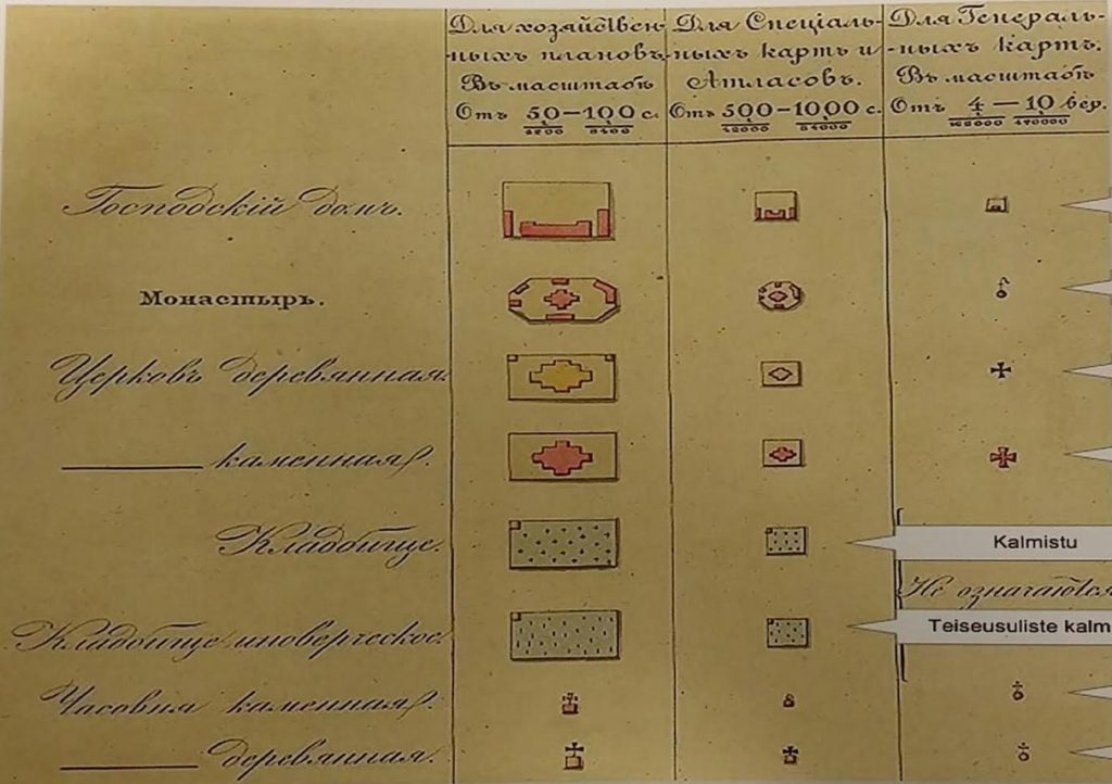
Top to bottom:
— manor house
— monastery
— wooden church
— stone church
— cemetery
— heterodox cemetery
— stone chapel
— wooden chapel

— bulk shaft
— stone fence
— wooden fence or fence
— cast iron (rail) road
— road with stone embankment
— tree-lined road (alley)
— road with stone pavement
— road with wooden pavement
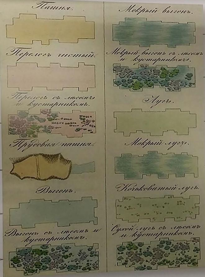
— arable land
— clean fallow (overgrown plot of land left uncultivated)
— fallow with forest and bushes
— pond arable land
— pasture
— pasture with forest and bushes
— wet pasture
— wet pasture with forest and bushes
— meadow
— wet meadow
— hummocky meadow
— dry meadow with forest and bushes

— rowing (a section of road through a swamp in the form of an embankment)
— small fascia
— large fascia
— post road
— large prochealka
— small country road
— cattle road
— trail
— winter road
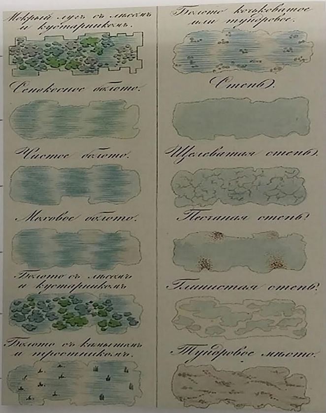
— wet meadow with forest and bushes
— hay swamp
— clear swamp
— moss swamp
— swamp with forest and bushes
— swamp with reeds and reeds
— hummocky or tundra swamp
— steppe
— crevice steppe
— sand wall
— clayey steppe
— tundra

— pine timber in the forest
— pine timber in low-lying and wet areas
— pine wood forest in the forest
— pine firewood forest in wet and low-lying areas
— boron in dry/wet place
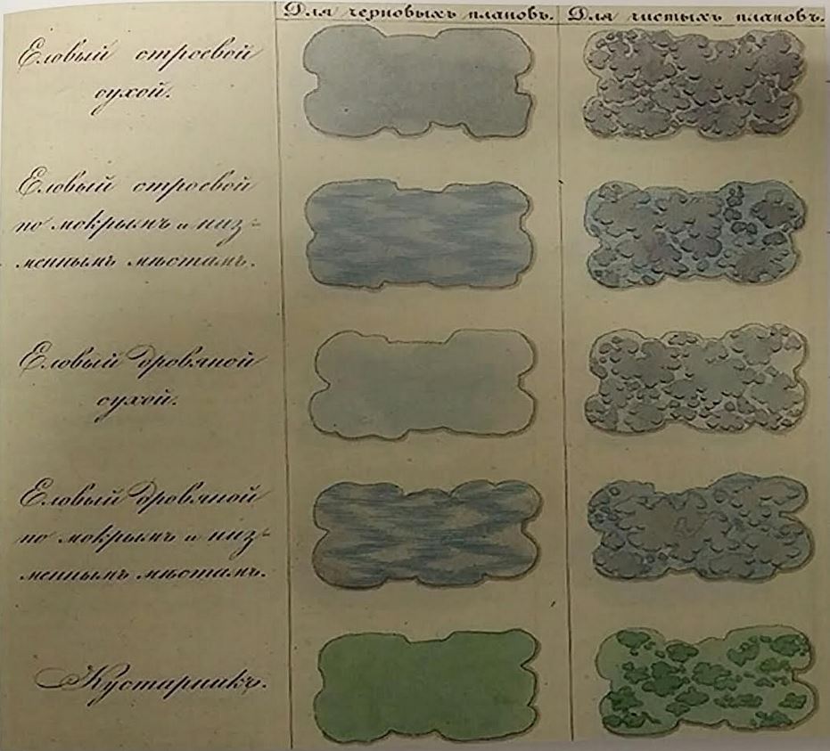
— spruce timber in a dry place
— spruce timber in a wet and low-lying place
— spruce firewood forest in a dry place
spruce firewood forest in a wet and low-lying place
— bush

— oak grove
— deciduous timber in a dry place
— deciduous timber in a wet place
— deciduous firewood forest in a dry place
— deciduous firewood forest in a wet place
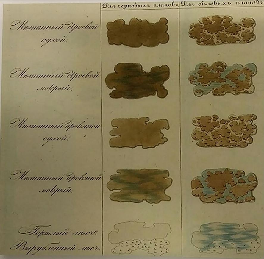
— mixed timber in a dry place
— mixed timber in a wet place
— mixed firewood in a dry place
— mixed firewood in a wet place
— burnt forest/cut down forest

— state border
— provincial border
— county border
— parish border
— estate border
— unconfirmed border
— village border
— border disputed
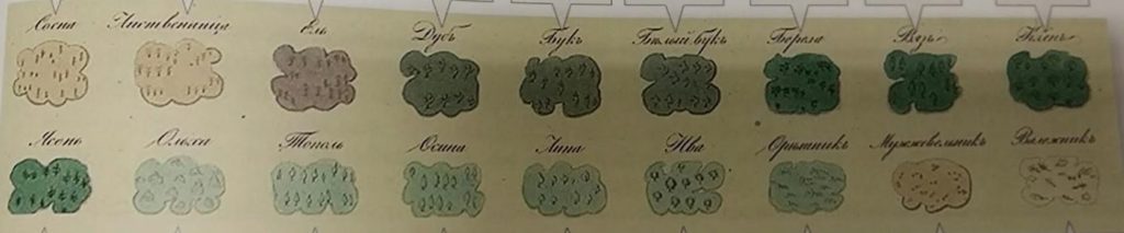
— pine
— larch
— ate
— oaks
— beeches
— white beeches
— birch
— ligature
— maples
— ash
— alder
— poplars
— aspen
— linden
— willows
— hazel trees
— junipers
— deadwood
Something to add?
Read more useful information in section.